TECHNICAL BUILDING MANAGEMENT

2D AND 3D BIM PLAN PROJECTION

DISCOVER ALL OUR AREAS OF EXPERTISE
projection-en-plan-2d-et-3d-bim

Create or recreate your plans using aerial and/or ground-based laser imagery, thanks to our solutions for new-build, renovation and refurbishment projects.

Precise plans for your projects

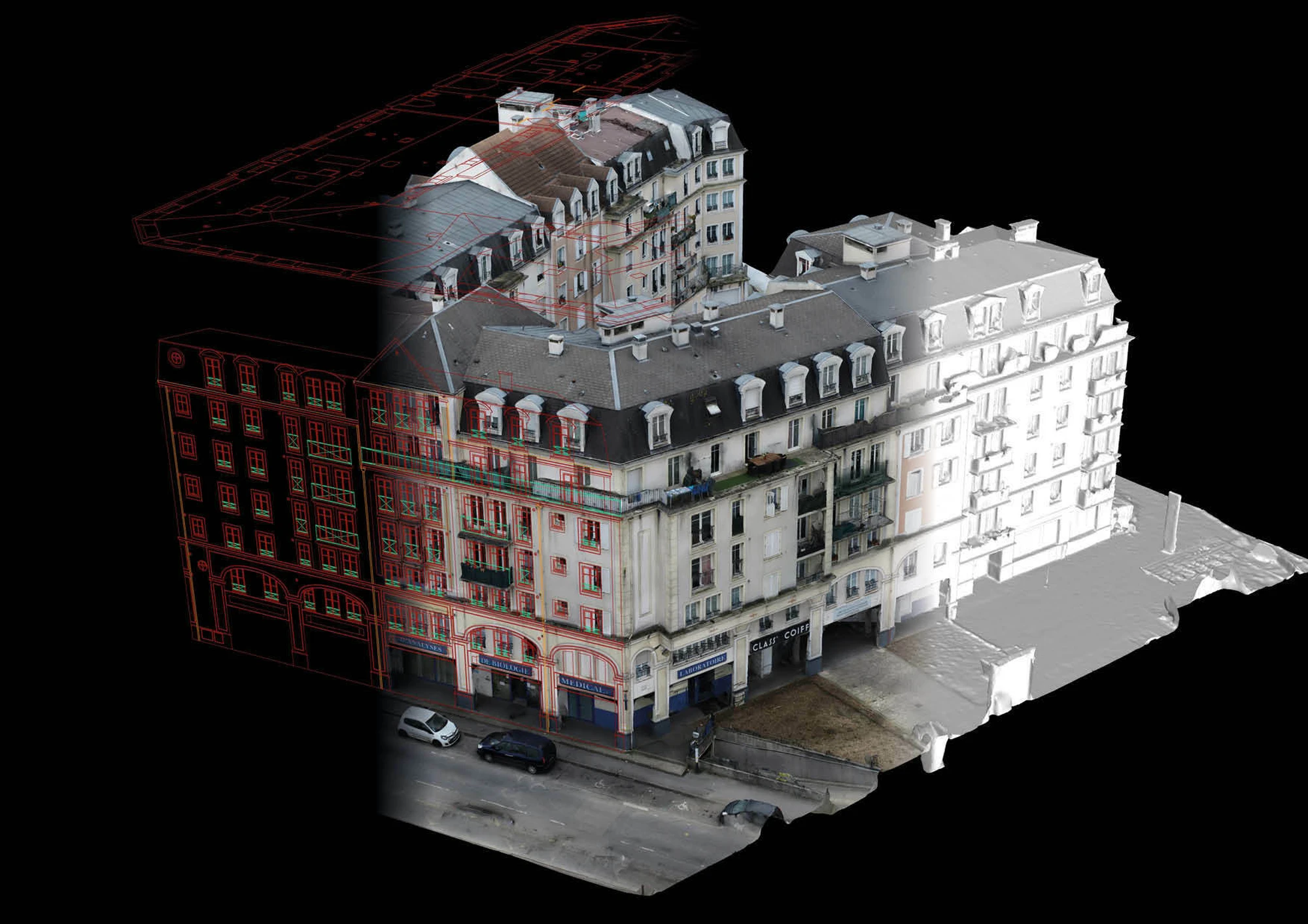
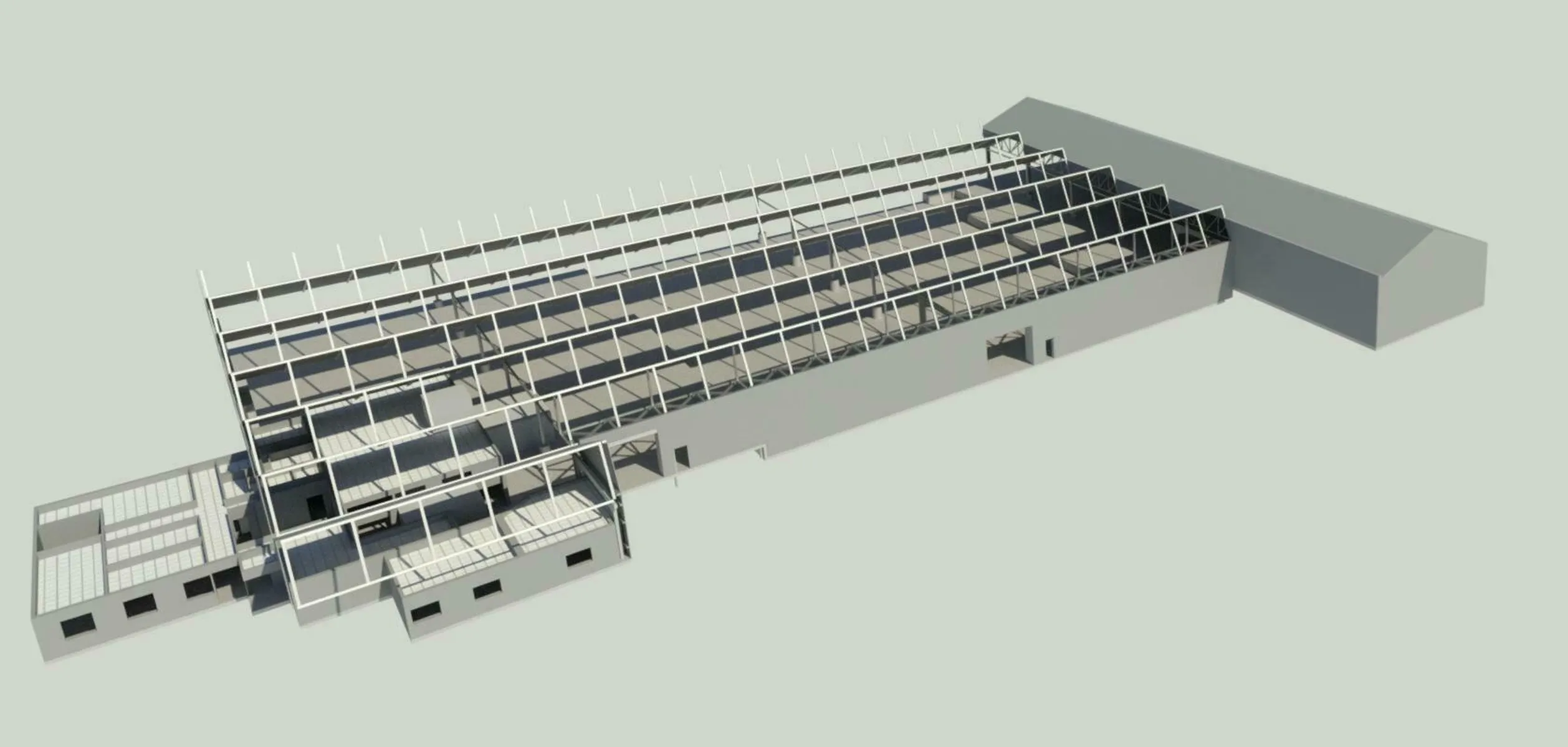
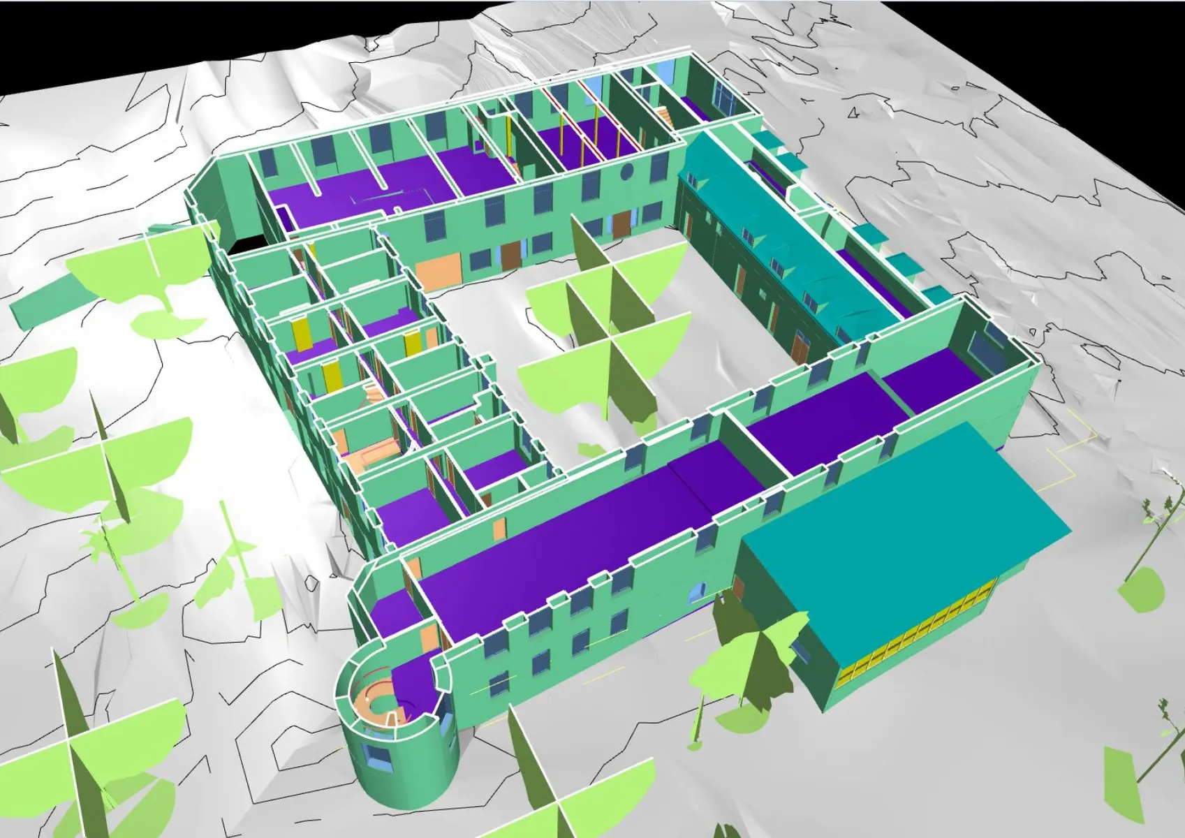
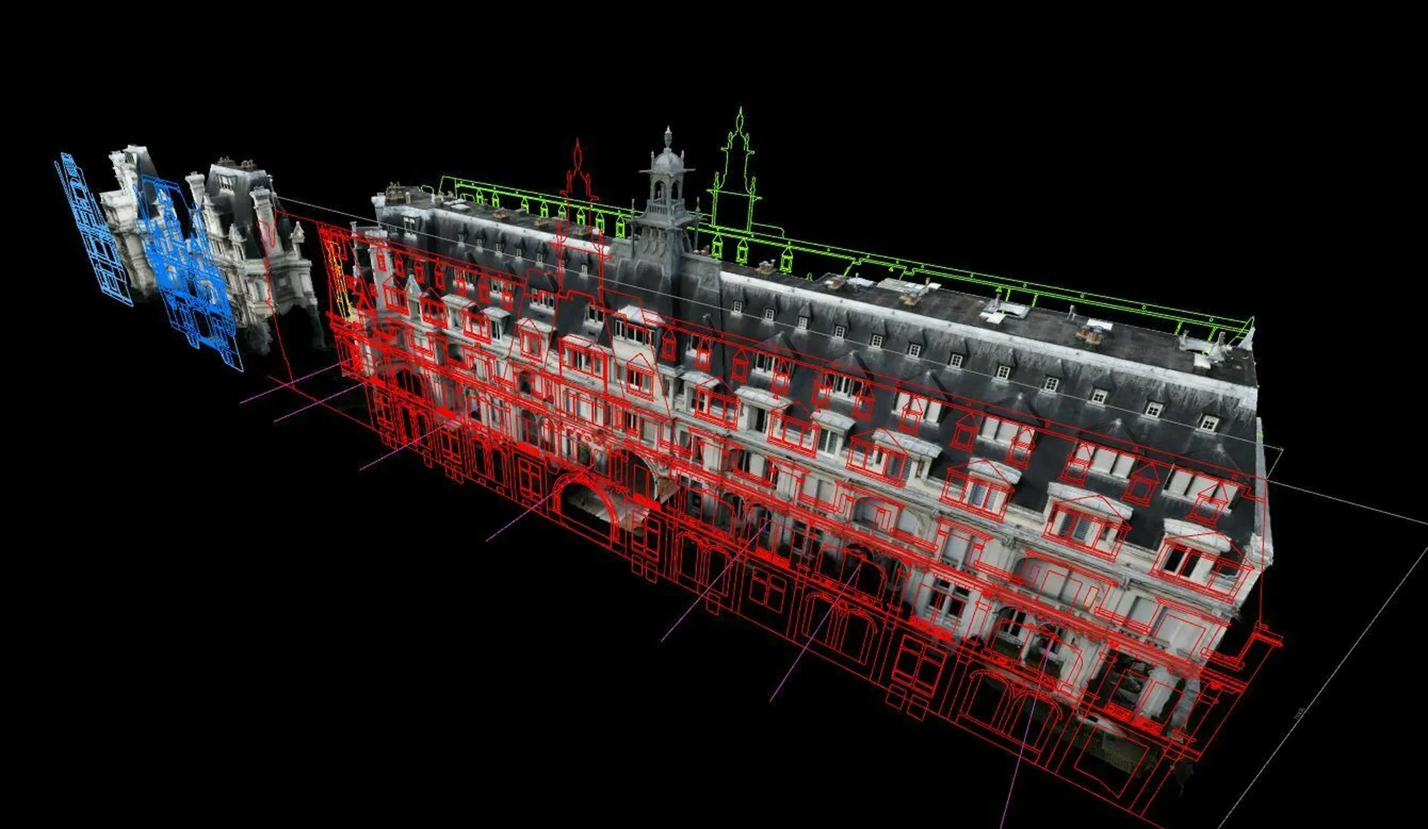
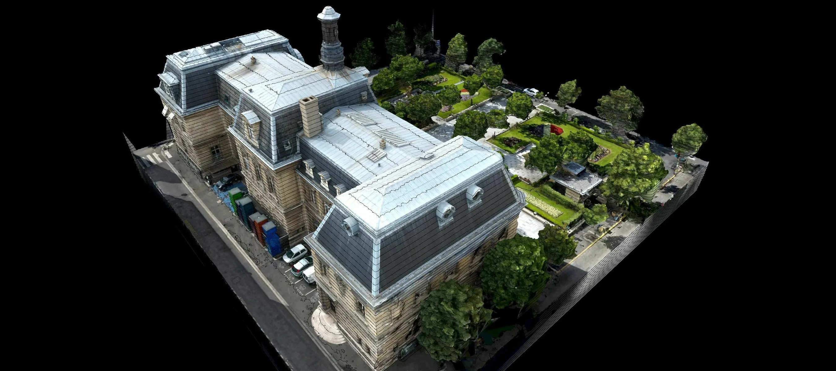
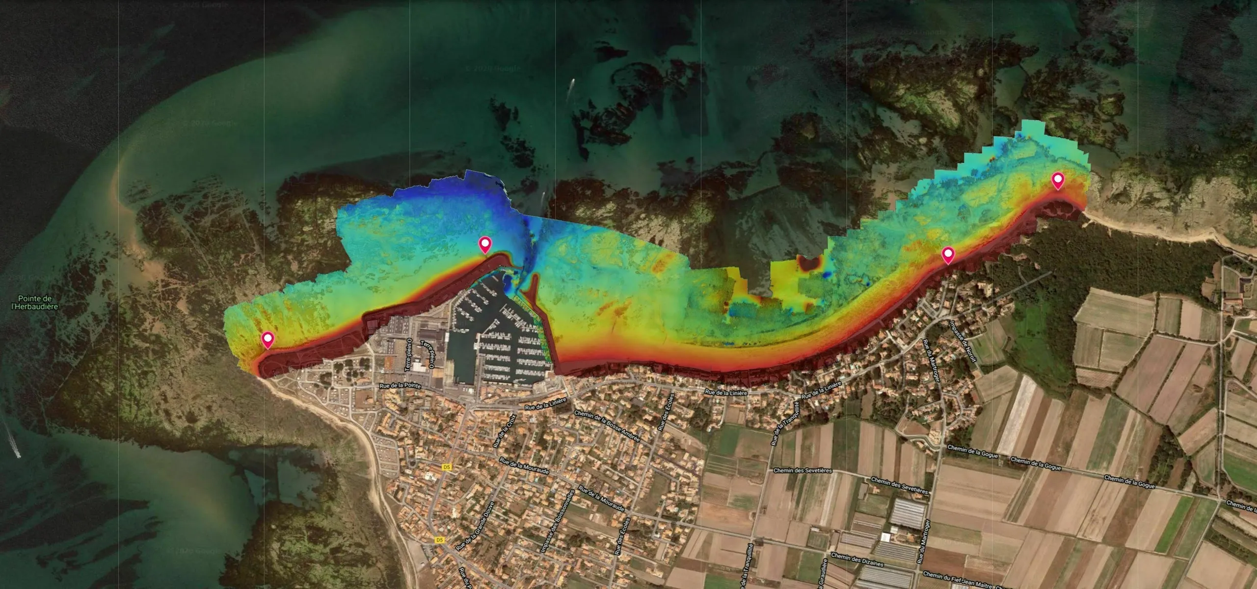
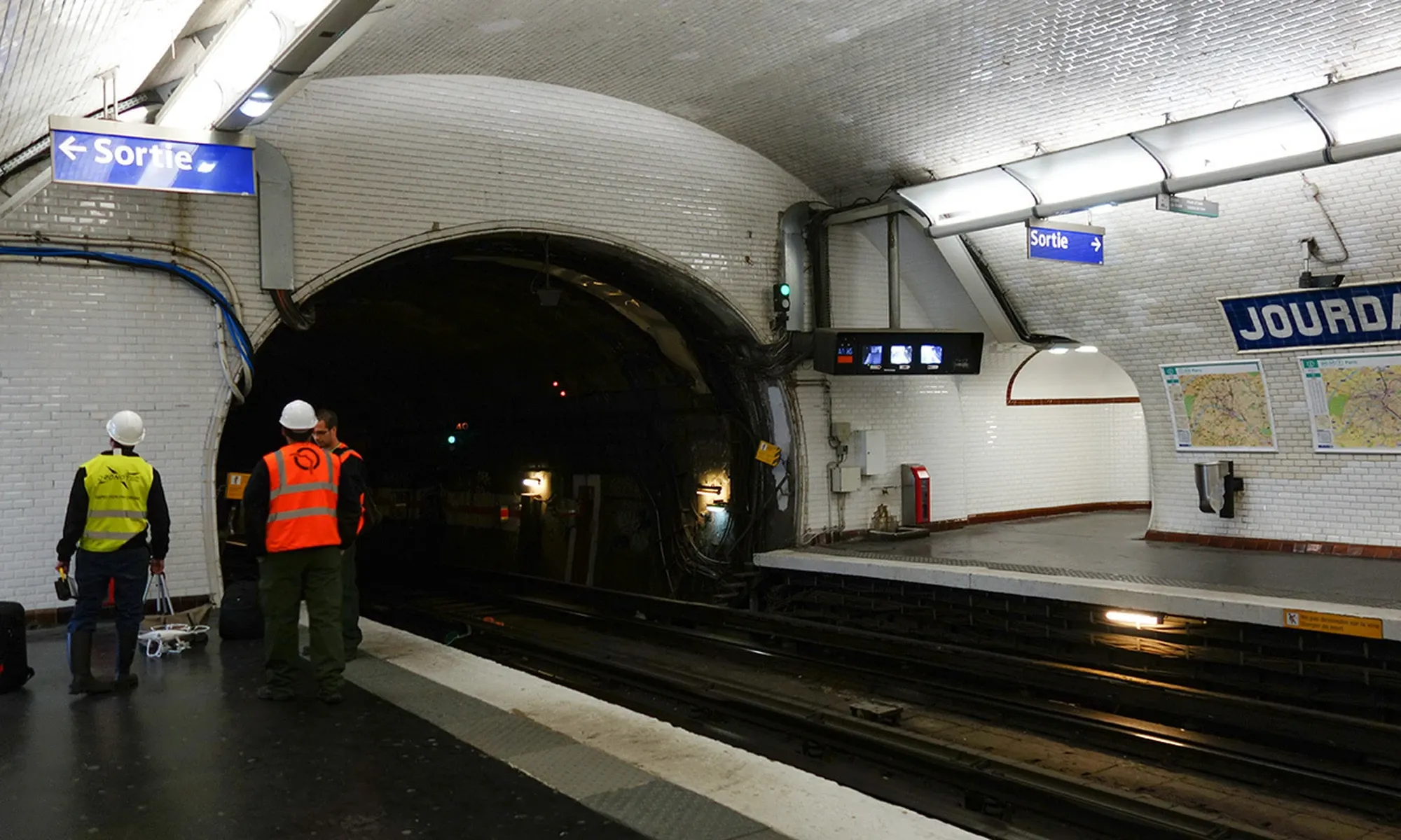
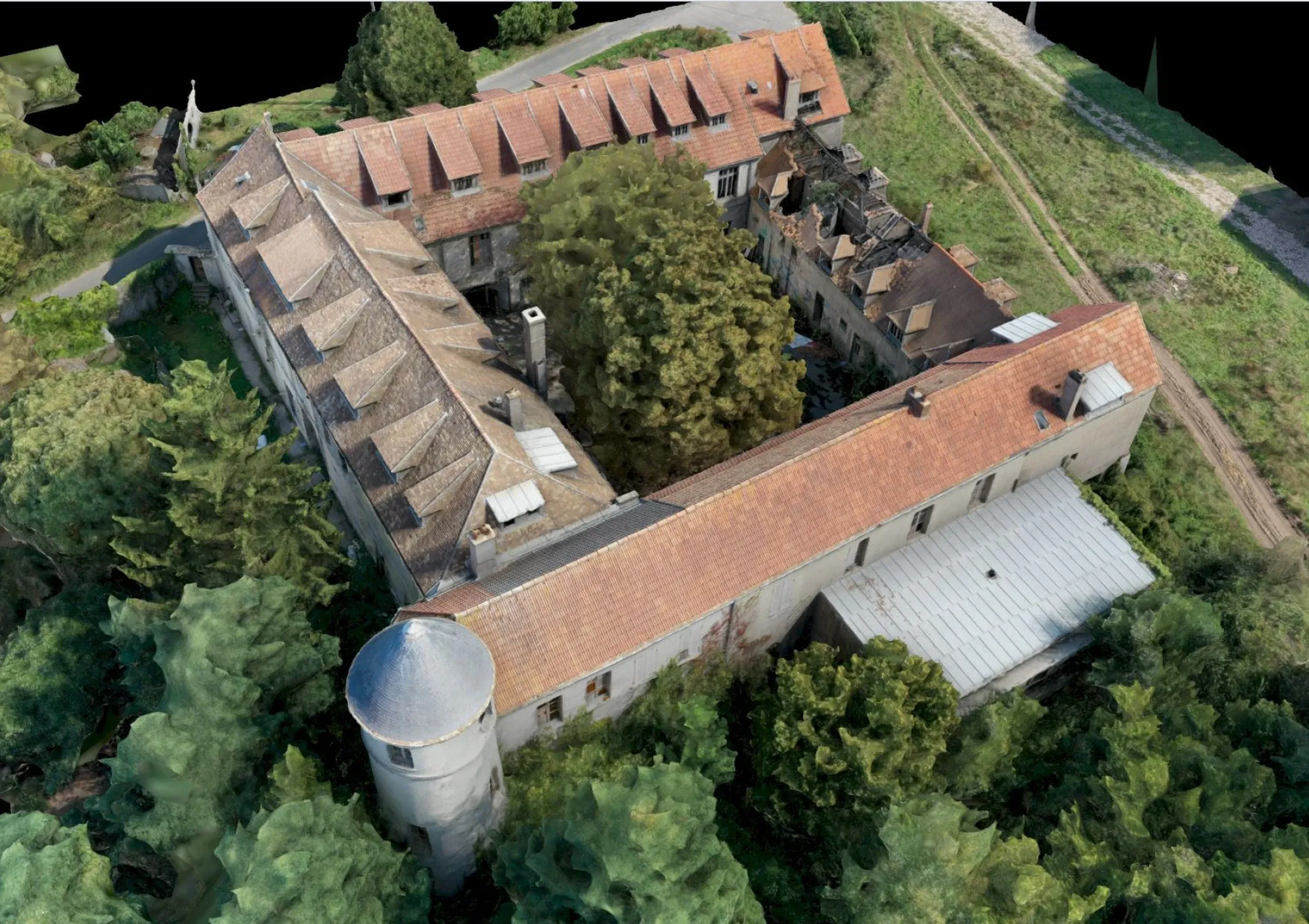
BIM (Building Information Modeling) is now an essential tool for managing construction and renovation projects. Dronotec carries out on-site surveys to produce 2D plans and 3D models (LOD 100 and 200). Our tools enable us to fully digitize any type of structure, from underground or interior spaces to roofs and facades. This service is ideal for quantifying lines of sight, estimating surface areas for restoration work or mapping plots, and can be carried out at various stages: pre-project study, creation of plans at the start of construction, or final presentation via virtual tours accessible online.

Subjects that may interest you
See more
>
3D MAPPING AND MODELING

Produce technical support for your missions with our mapping and 3D modeling solutions using drone and scanner.

DISCOVER
RISK MAPPING AND MODELING

Anticipate risks with drone mapping and 3D scanning, essential tools for preventing natural, industrial and technological risks.

DISCOVER
TUNNEL INSPECTION

Inspect and model your tunnels to obtain an accurate inventory while reducing risks to workers, thanks to our drones adapted to confined spaces.

DISCOVER
GET YOUR QUOTE NOW
A SAFETY-SEAM STUDY IS CARRIED OUT FOR EACH CASE
I GET MY QUOTE
DO YOU HAVE A QUESTION?
WE HAVE AN ANSWER
DOES DRONOTEC OPERATE ONLY IN FRANCE
OR DOES IT OFFER INTERNATIONAL SERVICES?
HOW LONG DOES IT TAKE ON AVERAGE FOR A
DRONE INSPECTION?
WHAT IS THE LIFETIME OF THE DATA AND IMAGES
PROVIDED BY DRONOTEC?
ACCESS THE F.A.Q
Thank you! Your submission has been received!
Oops! Something went wrong while submitting the form.