TECHNICAL BUILDING MANAGEMENT

DRONE SITE MONITORING

DISCOVER ALL OUR AREAS OF EXPERTISE
follow-me-by-drone

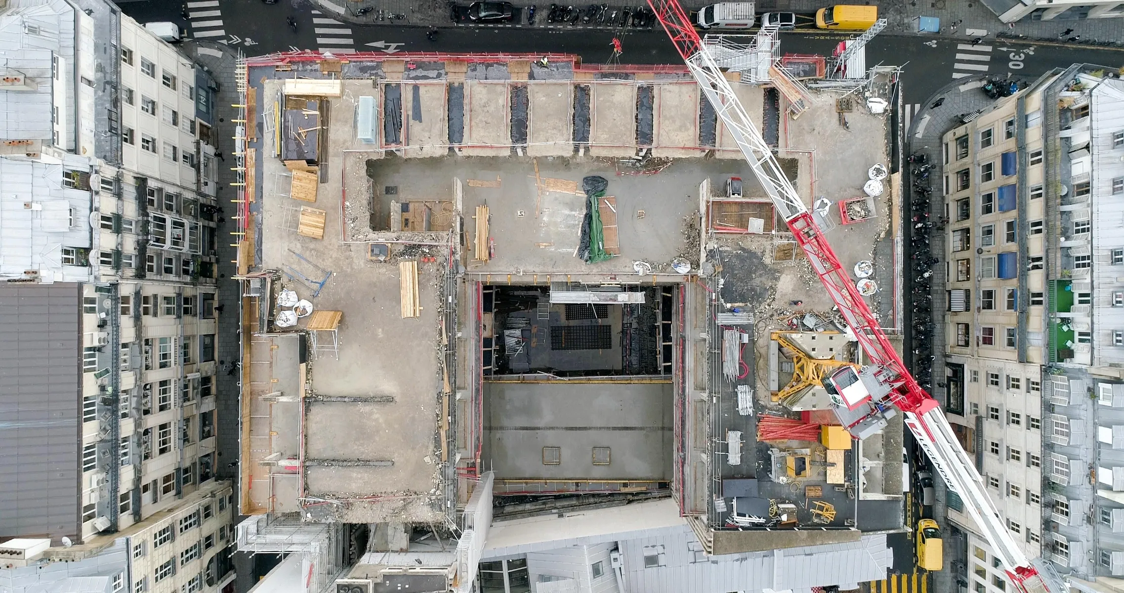
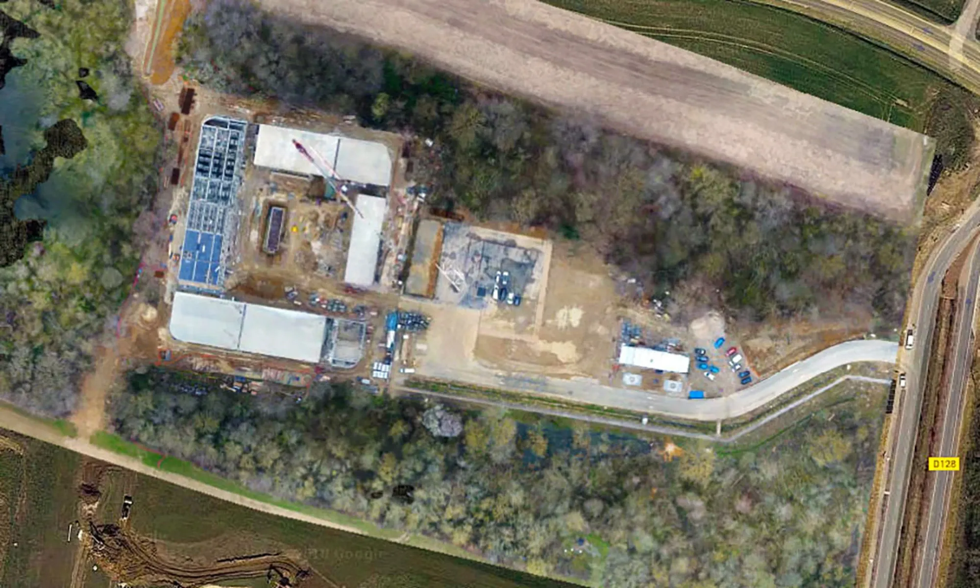
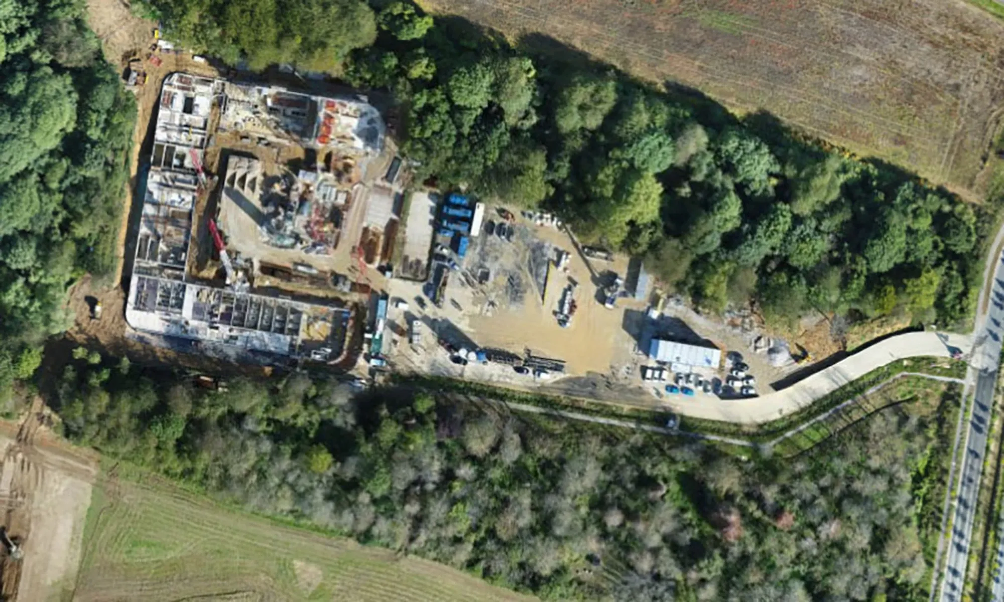
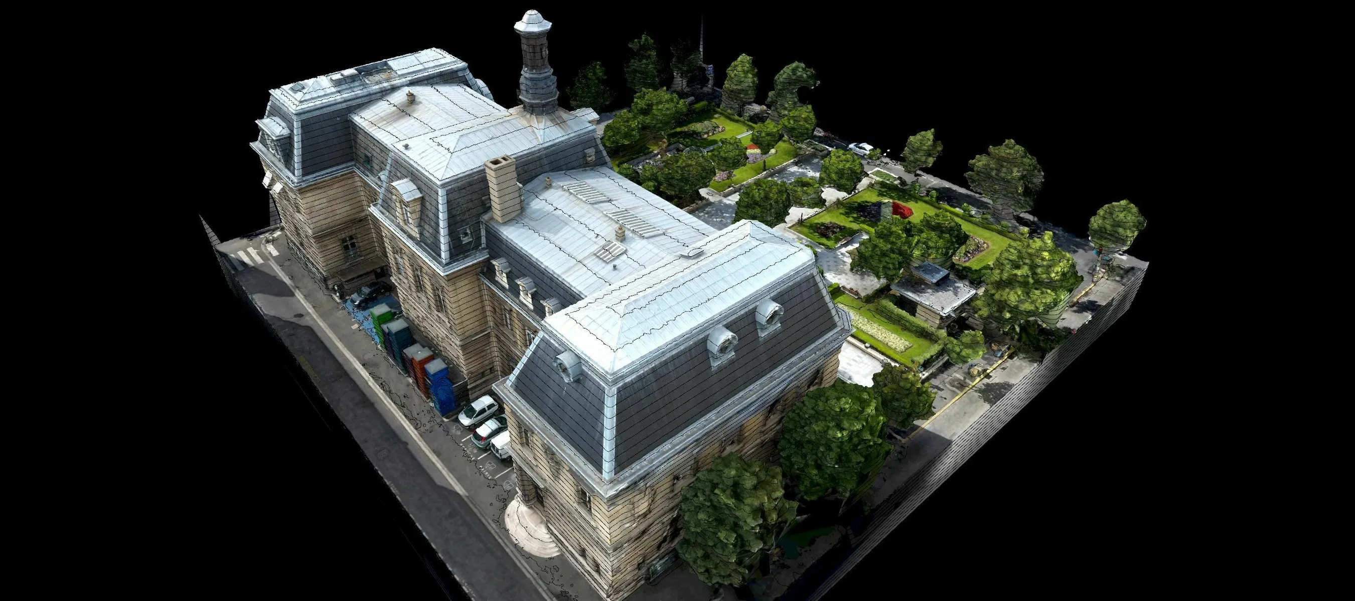
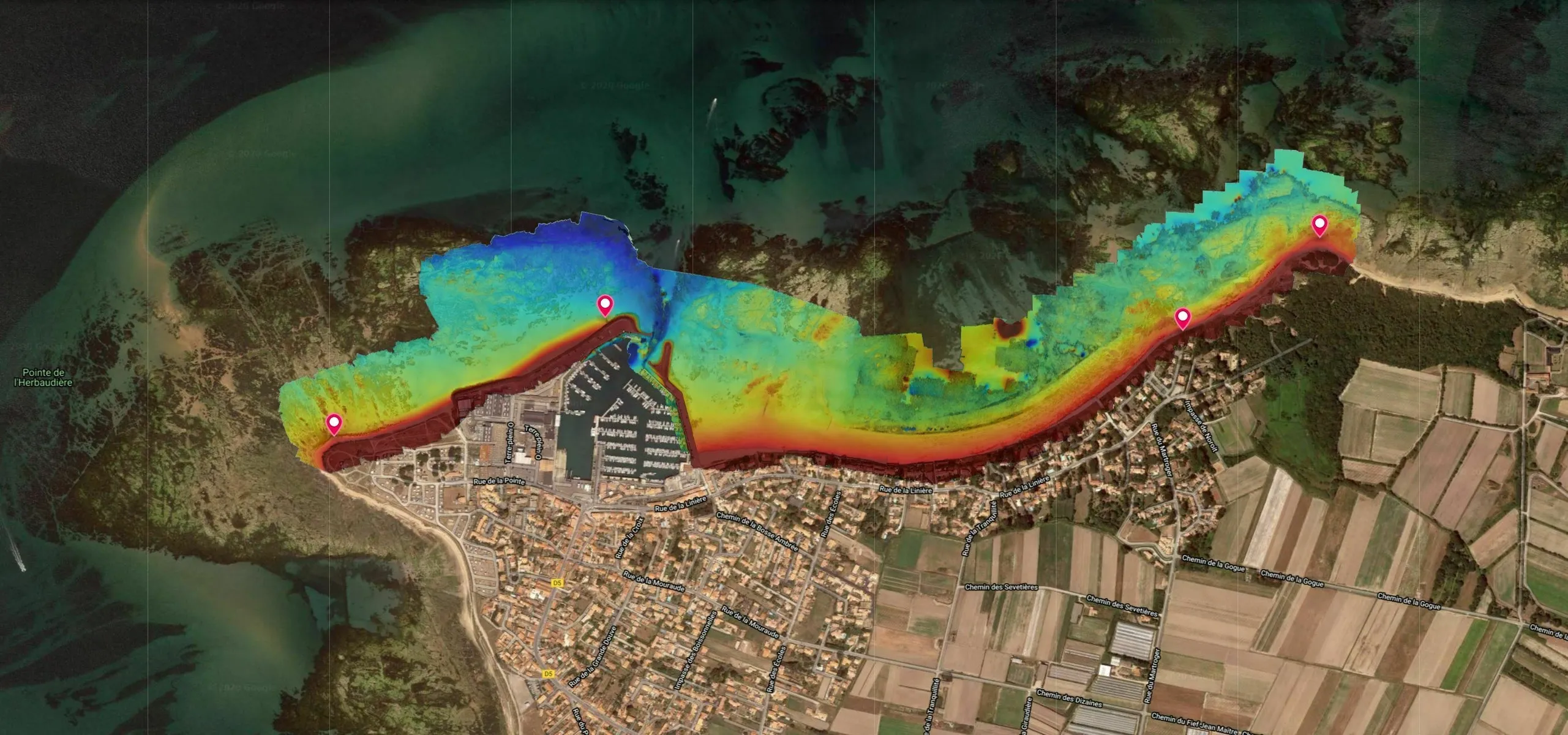
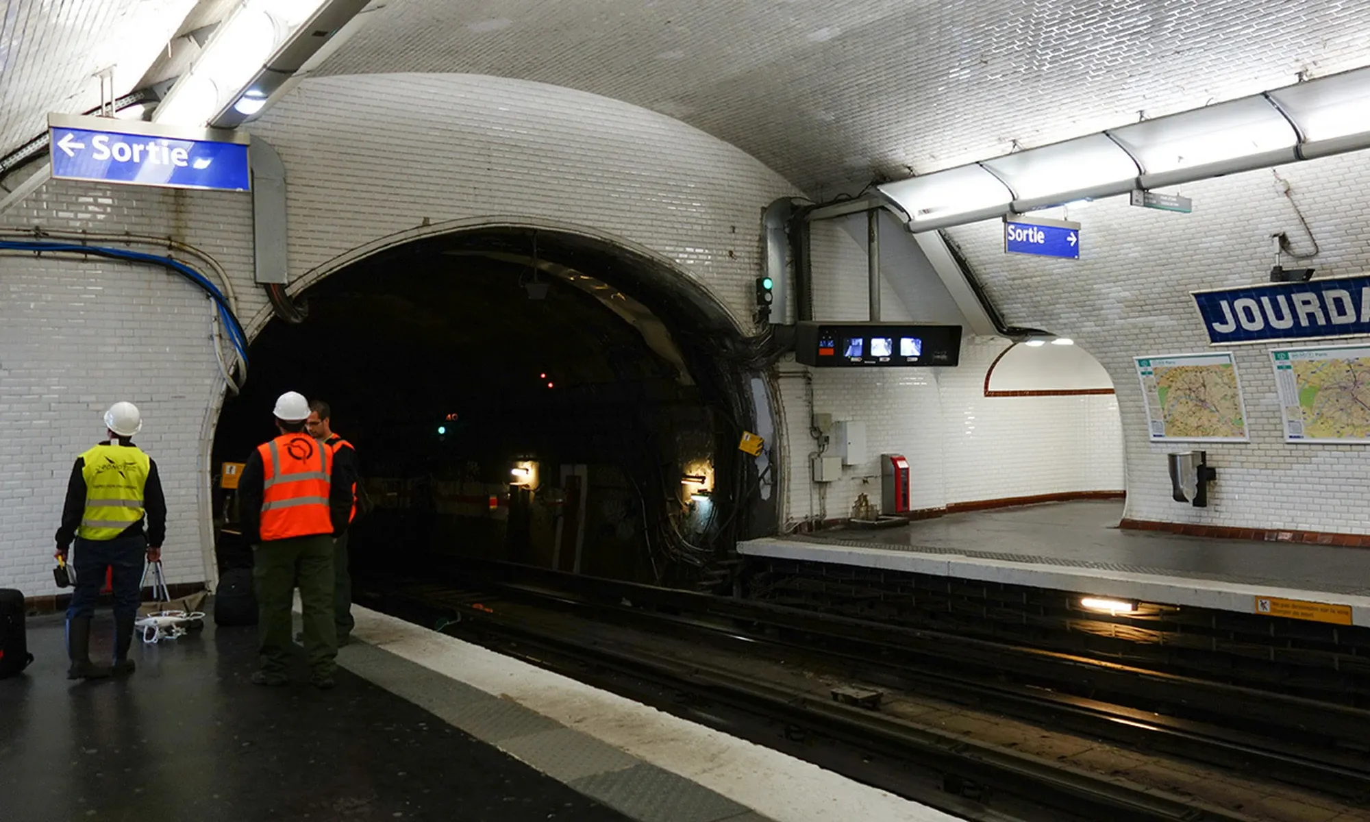
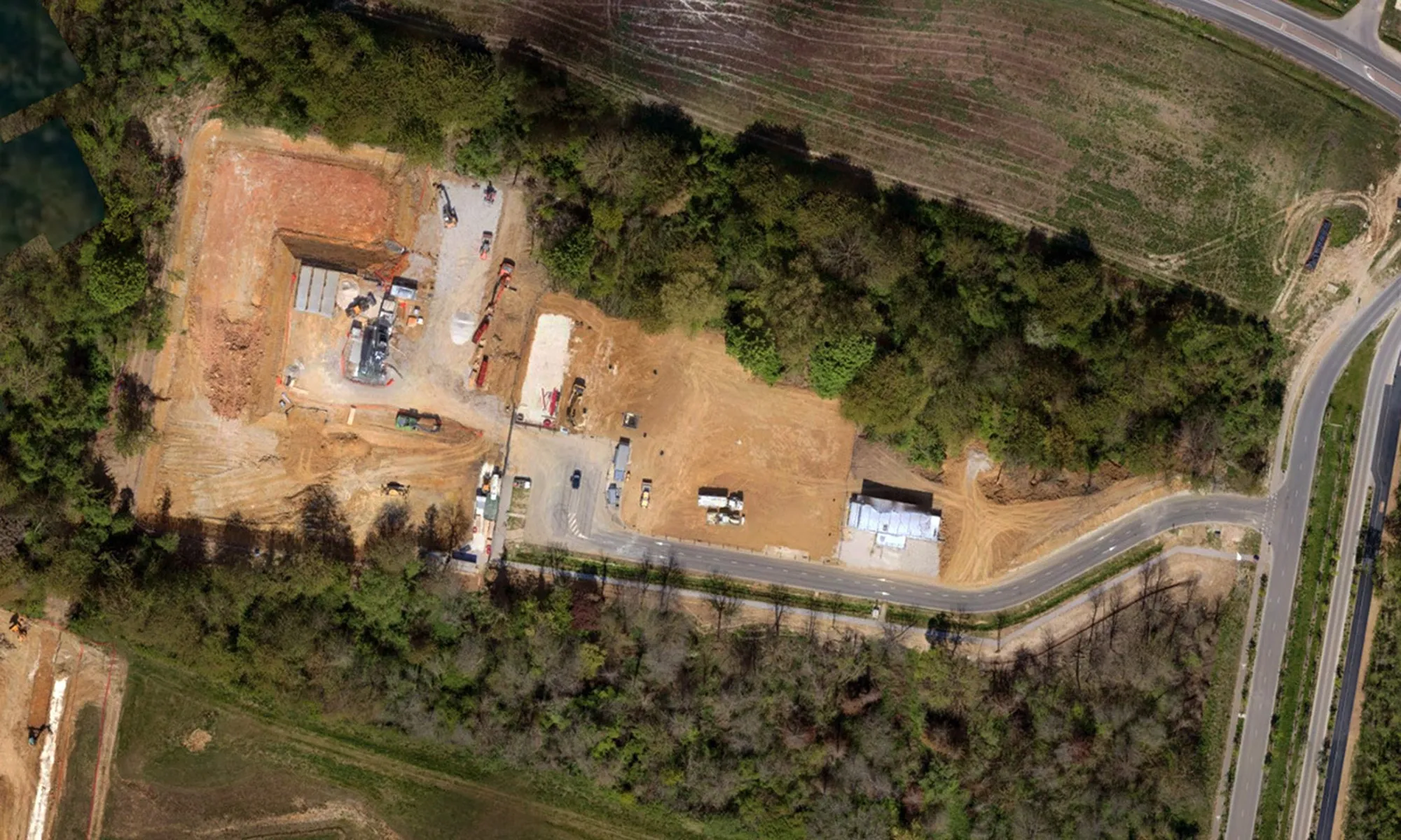
Visualize, control and archive the progress of your worksites with our collaborative drone and 3D scanner tracking solutions.

Collaborative tools for your worksites

Our drones enable regular, precise monitoring of your worksites at every stage, from preliminary study to handover. Thanks to digital twins and maps accessible on our online platform, you can visualize the progress of work, annotate data, share information with your teams and integrate your network plans. These tools also facilitate the detection of defects, the assessment of structural deformations via 3D scanner, and the creation of BIM-compatible digital media for your renovation or heavy restructuring projects. A key solution for saving time and optimizing project management.

Subjects that may interest you
See more
>
3D MAPPING AND MODELING

Produce technical support for your missions with our mapping and 3D modeling solutions using drone and scanner.

DISCOVER
RISK MAPPING AND MODELING

Anticipate risks with drone mapping and 3D scanning, essential tools for preventing natural, industrial and technological risks.

DISCOVER
TUNNEL INSPECTION

Inspect and model your tunnels to obtain an accurate inventory while reducing risks to workers, thanks to our drones adapted to confined spaces.

DISCOVER
GET YOUR QUOTE NOW
A SAFETY-SEAM STUDY IS CARRIED OUT FOR EACH CASE
I GET MY QUOTE
DO YOU HAVE A QUESTION?
WE HAVE AN ANSWER
DOES DRONOTEC OPERATE ONLY IN FRANCE
OR DOES IT OFFER INTERNATIONAL SERVICES?
HOW LONG DOES IT TAKE ON AVERAGE FOR A
DRONE INSPECTION?
WHAT IS THE LIFETIME OF THE DATA AND IMAGES
PROVIDED BY DRONOTEC?
ACCESS THE F.A.Q
Thank you! Your submission has been received!
Oops! Something went wrong while submitting the form.